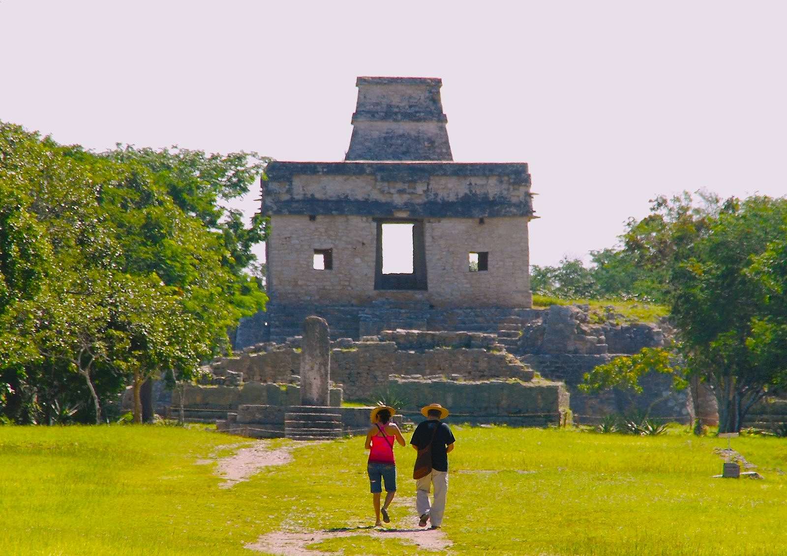

Once a vast city of 40,000 spread across 8 square miles or so of jungle and meadows, Dzibilchaltún was a long-lived Mayan city, a major player in the salt trade, and the ultimate survivor. Founded around 300 B.C., Dzibilchaltún lasted until the arrival of the Spanish in 1540. An architectural marvel even now, as it lays in ruins, it was so craftily designed that those on the roof of “Templo de las Siete Muñecas” (Temple of the Seven Dolls),had an unhindered 360-degree view of the world around them. But even more impressive, for someone who still remembers Mr. Kaminski’s eighth grade geometry class with horror, the engineers, mathematicians, and astronomers designed the temple so accurately that, during both spring and autumn equinoxes, the rays of the rising sun beam directly through the castle’s ports, casting a reddish glow throughout.
It’s akin to what occurs those same days at El Castillo in Chichen Itza where the carefully calculated equinox alignment of the sun creates the image of the feathered serpent known as Kukulkan slithering down the 91 steps of El Castillo. Even Mr. Kaminski couldn’t have figured that one out.
The Archaeological Site of Dzibilchaltún
We came to Zona Arqueológica de Dzibilchaltún from the marvelous city of Merida, traveling north on the Mérida-Progreso highway. Our first stop upon arrival was at the Museo Pueblo Maya, the historic site’s air conditioned museum. The latter is important because even early in the day, the heat index including temperature and humidity is set to “hell.” Luckily, there’s a museum store Having quickly realized that my baseball cap wouldn’t be enough protection from the blazing sun, I bought a floppy cotton hat with an extended brim on all sides, not even bothering to look in the mirror. I don’t want to know if it looks good on me, for once I don’t care.
Then we grabbed bottled waters and perused the exhibits. The seven dolls are here, not far from the temple where they were found. Their rudimentary forms boast enlarged sex organs. Their purpose? Explanations range from the simple—they were part of a ritual–to the more complex—lined up correctly, they align with the shield carried by the constellation Orion enabling shamans and astronomers to predict the best days to sow and harvest crops. Since Dzibilchaltún was an agrarian society, I can see why that would be important.
As the Orion shield thing is way beyond my capacity, I moves on to other exhibits. The museum is a wonderful collection of exhibits and artifacts reflecting Dzibilchaltún’s history. Because the city survived for such a long time (quick – can you name more than a handful of cites beyond Jerusalem, Athens and Rome that date back 1200 years or more?) they provide a look at the changing periods of Mayan culture.
What to Explore
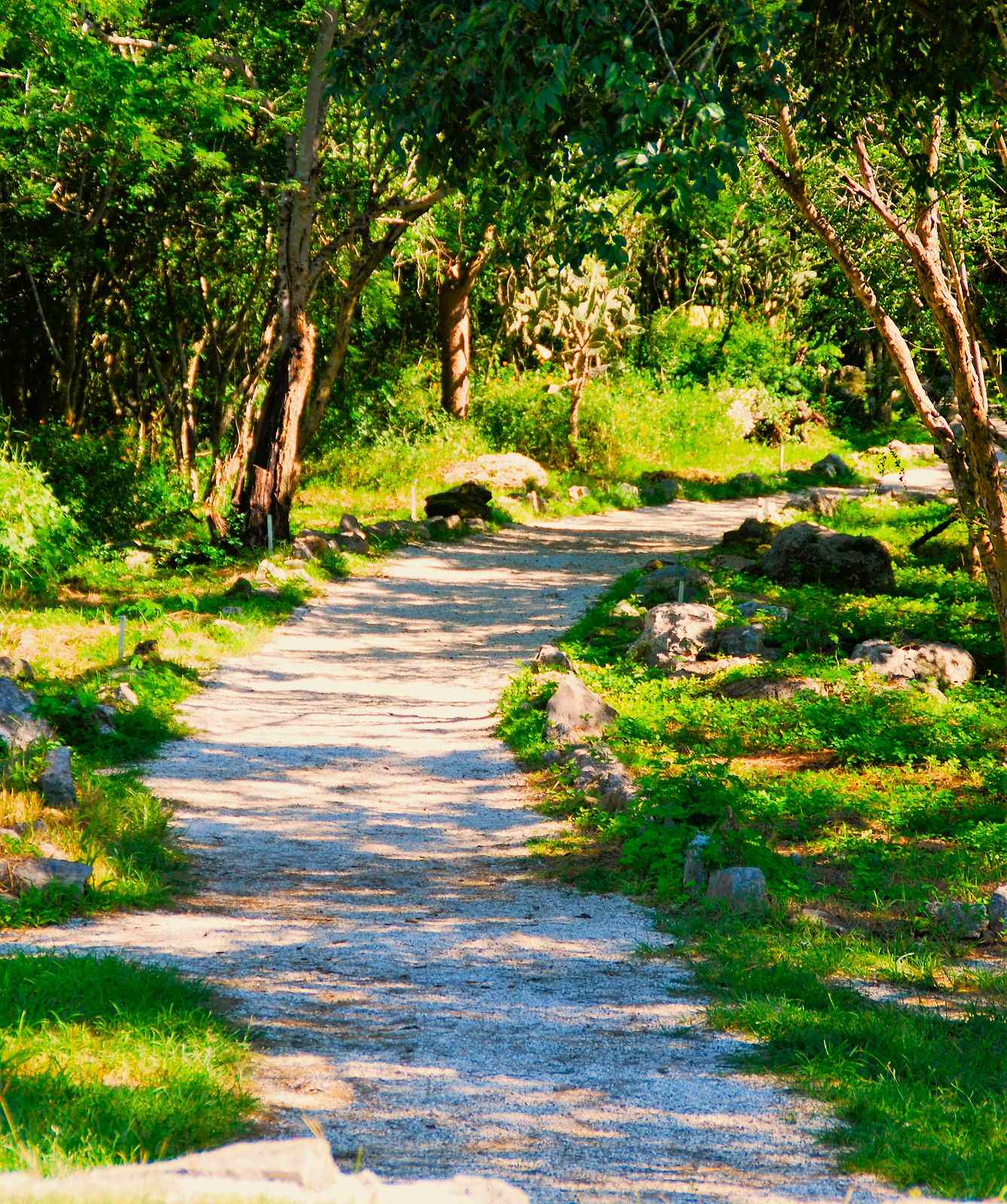
From the museum we walked to the city itself. Dzibilchaltún is no Chichen Itza, or at least not yet. The name means “where there is writing on flat stones” and, indeed,ancient graffiti still cover walls and buildings. Though archaeologists have pinpointed over 8000 structures still needing to be excavated, there are eight or so to explore. The Mayans like to play ball, so there’s a ball court, of course. The 427-foot Central Plaza that served as a government building is one of the longest Mayan buildings to be excavated so far anywhere in the Mayan world. This was the place where the administrative work of the city got done. Though I’m sure the Mayan administrators didn’t carry briefcases and talk on smart phones, a city of this size must have required layers and layers of an organized bureaucracy to function effectively. That they did an excellent job is a given, considering how long Dzibilchaltún survived.
Before the Spanish
Another excavated structure housed the governing elite, and is also the burial site for Kalom Uk’uw Chan Chae, one of the rulers of Ch’iy Chan Ti Ho, the name of this city before the Spanish came and renamed it Dzibilchaltún.
I was glad we had hired a guide and that I’d brought along a notebook and pen. There’s not much in the way of markings or explanations here, and I often had to ask our guide, who was very nice, how to spell some of the names and explain what the buildings were used for.
We climbed to the top of a small pyramid (if it had a name, I missed it) which offered a magnificent view of the city including the first building ‘discovered.’ That was in 1940 and was called Last Standing, because—in all of the vast city’s history—it was the only one remaining. Looking around at the flat expanse of grasses and foliage, it’s difficult to imagine that there are still approximately 8000 or so structures in this archaeological site which remain below ground, just waiting to rise again. What Dzibilchaltún will look like when they are unearthed is hard to fathom.
White Roads
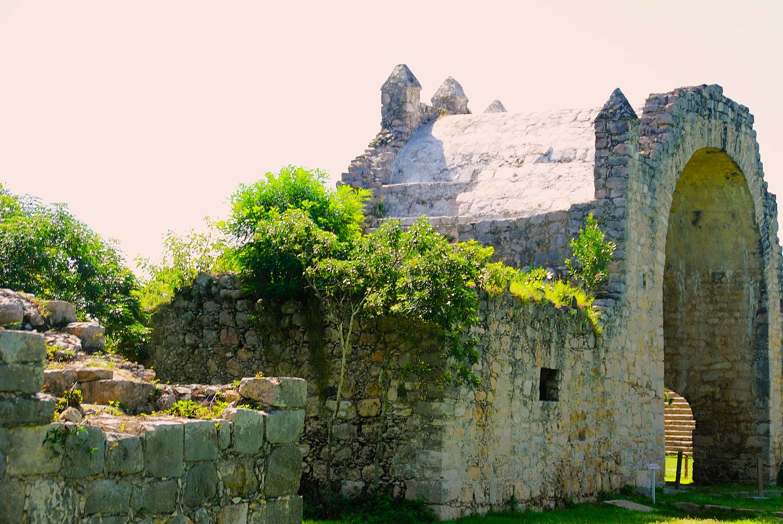
Twelve sacbes (or more officially ‘sacbeob,’ the plural) or white roads, so called because they were covered with limestone, connect different sections of the city. Like all Mayan cities, Dzibilchaltún is fascinating. Each Mayan ruin is o different and unique. We check out the open air chapel or church, a mere five six years old as it was built by the Spanish who were relative newcomers and then, head to our last stop–Cenote Xlacah.
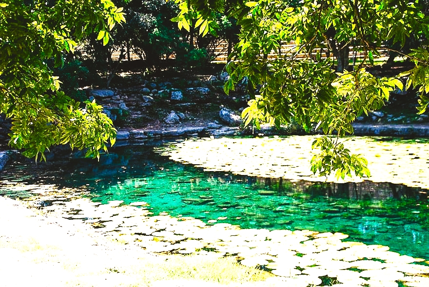
Cenote Xlacah
Cenote Xlacah is a great stopping point as I’d about had it with the blazing sun, new hat and all.
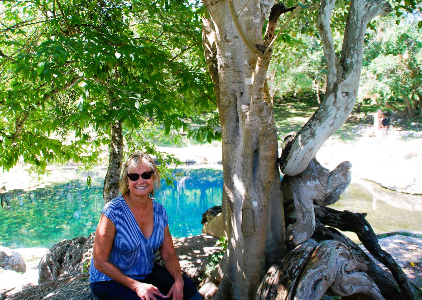
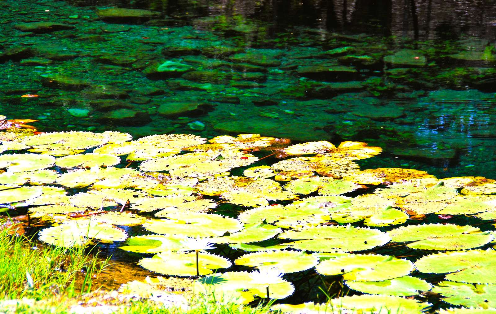
We sat by the edge of what was Dzibilchaltún’s main source of water, a placid looking pond. But it’s an illusion. We’re seeing the placid surface of Cenote Xlacah, dotted with water lilies and looking like nothing more than a smallish pond. In fact, what lies beneath is a vast underground system of water ways. The measurable depths here reach down 144 feet, making Xlacah among the largest and deepest of all the hundreds of cenotes in the Yucatán Peninsula. Bigger even than Chichen Itza’s Sacred Well, and surrounded by stones and a few trees, it’s an inviting spot. So inviting that I was among the few who gave in, and slipped into the waters. Sure, I was wearing clothes but in this heat the dried soon enough, and there was no chance of catching cold.
Warm on top, baked from the hot sun, the levels below grew cooler and cooler as I went further down. I don’t continue the journey for long because, though Xlacah’s waters are clear, our guide tells us that (like Chichen Itza 85 miles southwest) the cenote was used for religious ceremonies and all that means. So I don’t let myself dwell on what lies beneath. Besides, that was such a long time ago.
Related articles on MexConnect
- Interactive Map of Quintana Roo
- The Ancient Maya – A Commercial Empire (David Conrad)
- The Maya civilization: Historical conflict (Luis Dumois)