The 100-mile road which winds from Creel, elevation 7,500 feet, to Batopilas, 1,650 feet, is narrow and — at points — treacherous, especially in the last 30 or so miles. This part of Mexico's Copper Canyon is remote and rugged. © Geri Anderson 2001.

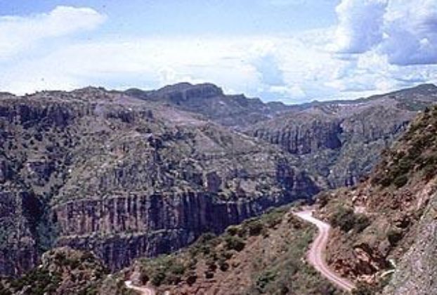
Chihuahua’s Copper Canyon: the treasure of the Sierra Madres

Alongside the railroad tracks at Divisidero, two Tarahumara Indian ladies silently weave pine needle baskets. Pine scent permeates the air. The tracks begin to vibrate. Soon the Chihuahua-Pacifica train screeches to a halt. For 15 minutes, tourists rush past the Indians and the maze of souvenir and burrito stalls to catch a glimpse of interlocking […]

Continue Reading

Mexico’s Copper Canyon spans Chihuahua and Sinaloa: introduction and resources

The most common way to visit Copper Canyon is by train, which runs from Los Mochis to Chihuahua – one of the few remaining passenger trains in Mexico. While this rail trip offers spectacular views, passengers do not get an opportunity to go deep into the canyon. Therefore, a few years ago, I opted to […]

Continue Reading
The 100-mile road which winds from Creel, elevation 7,500 feet, to Batopilas, 1,650 feet, is narrow and — at points — treacherous, especially in the last 30 or so miles. This part of Mexico's Copper Canyon is remote and rugged. © Geri Anderson 2001.

Copper Canyon crossing: Hiking the Sierra Tarahumara

The Sierras: The Sierra Tarahumara is literally a land lost in time. Probably the most rugged and least explored areas of the Sierra Madre Occidental. Though known around the world as the Copper Canyon, the Copper Canyon is only one canyon, in a system of canyons. Approximately, 25,000 square miles of high sierras, with a […]

Continue Reading