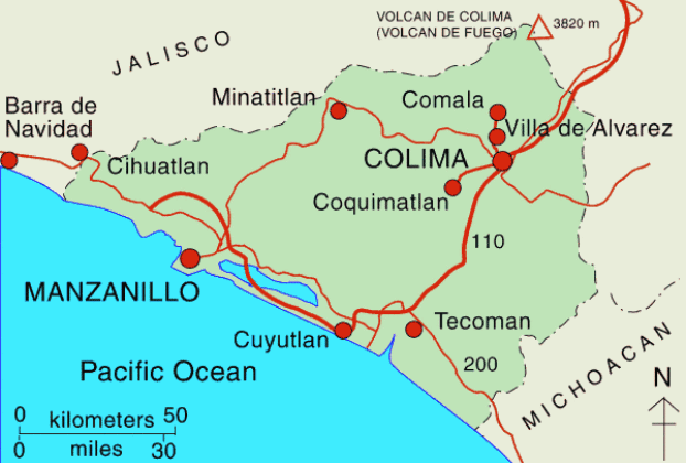
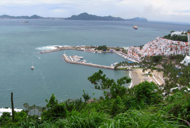
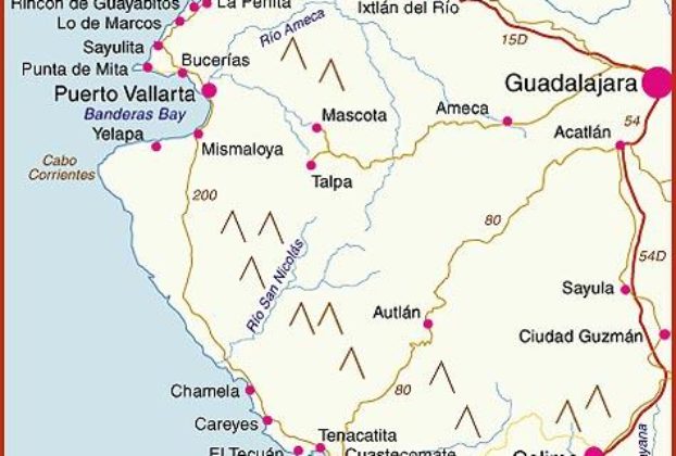
Interactive map of Pacific Coast beaches: Jalisco, Nayarit, Colima, Michoacán, Mexico

Interactive map of Pacific Coast beaches: Jalisco, Nayarit, Colima, Michoacán, Mexico

Interactive map of Pacific Coast beaches in the states of Jalisco, Nayarit, Colima and Michoacán, Mexico The interactive map shows the coasts of the states of Nayarit, Jalisco, Colima and Michoacán. These states all have some great beaches, and tourism is an important activity in many of the towns shown on the map. Some of […]

Continue Reading

The state of Colima, Mexico – basic information

Colima is the third smallest of Mexico’s 32 states. Nestled between Jalisco to the north, Michoacán to the east, and hugged on its western boundary by the Pacific Ocean, it covers an area of 2,106 square miles (5,455 kilometers), with a coastline extending 97.5 miles (157 kilometers) and territorial waters claiming 823.5 square miles (2,133 […]

Continue Reading

TAGS – States, Regions, Cities

Aguascalientes, Baja California, Baja California Sur, Campeche, Chiapas, Chihuahua, Coahuila, Colima, Durango, Guanajuato, Guerrero, Hidalgo, Jalisco, México (State of), México City, D.F., Michoacán, Morelos, Nayarit, Nuevo León, Oaxaca, Puebla, Queretaro, Quintana Roo, San Luis Potosí, Sinaloa, Sonora, Tabasco, Tamaulipas, Tlaxcala, Veracruz, Yucatán, Zacatecas,

Continue Reading