Interactive Map of Colima
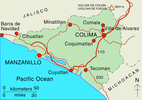
The state of Colima, one of the smallest in Mexico, is in Mexico’s Central Pacific Region, along with the states of Jalisco, Michoacán and Nayarit.
Colima has an area of about 5,500 square kilometers and a population of 715,000 (2017 estimate). The state’s capital city is Colima.
Colima Volcano, on the northern limits of the state, is one of the westernmost volcanoes in Mexico’s Volcanic Axis, and one of the most active and dangerous. Colima Volcano’s summit is only 8 kilometers (5 miles) from the inactive Nevado of Colima volcano, Mexico’s sixth-highest peak, which rises 4260 m (13,976 ft) above sea level. (Lovers of geographical trivia should note that, despite their names, the summits of both volcanoes are actually located in the state of Jalisco, not in the state of Colima.)
Numerous villages in the shadow of Colima Volcano keep a wary eye on its level of activity, and emergency evacuations have become a regular event over the past fifty years.
The state’s important tourism sector is centered on the Pacific coast resort town of Manzanillo, which is also one of Mexico’s most important ports. Further south the popular beach town of Cuyutlan was an important center for salt production; its black sand beach and “green waves” attract many local tourists.
This clickable interactive map of Colima state, Mexico: Colima, Manzanillo, Cuyutlan, Tecoman – Published or Updated on January 1, 2002