Interactive Map of Nayarit, Mexico
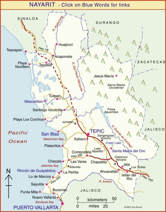
The state of Nayarit is in Mexico’s Central Pacific Region, along with the states of Colima, Jalisco and Michoacán. The state has an area of about 27,800 square kilometers and a population of 1.2 million (2017). The capital city of the state of Nayarit is Tepic.
Tourism is important to the state’s economy. The coast of Nayarit varies from white sand beaches in the southern part of the state (which includes tourist towns such as Nueva Vallarta and Sayulita) to the virtually-uninhabited coastal marshes and swamps of the Marismas Nacionales. The town of San Blas was important historically, during colonial times, as a shipbuilding and provisioning port for voyages between Mexico and Asia.
The rugged eastern part of the state, that borders Zacatecas and Jalisco is home to the indigenous Huichol people, whose distinctive lifestyle, customs and handcrafts are exceptionally well documented on MexConnect – see Huichol Resource Page.