This page is number 7 of seven pages on MexConnect which come originally from the website of CEDEX (Center for Historic Studies of Public Works and Town Planning) in Madrid, Spain. (Links to the other six pages are provided at the end of the article). The pages reflect an exhibition organized by CEDEX in 1988, entitled “Manila 1571–1898, The West in East”.
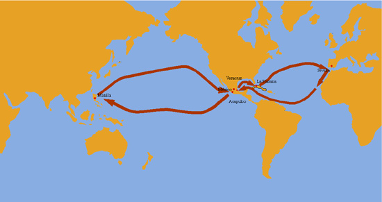
Transoceanic voyages set off from the eastern coasts of New Spain in an effort to find a new route leading to Asia, as there was a race with the Portuguese to be the first to arrive there. This is the second leg of the journey: the sea once more.
It was Christopher Columbus’ dream to find the spice lands, and this was the underlying reason why one voyage after another across the Pacific Ocean was undertaken during the 16th century. One of the most emblematic voyages of discovery was that of Magellan, who discovered the Philippines; Elcano followed the route that had been established and was the first Spaniard to sail around the world. These early explorers spurred others on to undertake the voyages of exploration that were to occur over that century.
In 1525, García de Loaísa followed the Magellan route under orders of the Emperor, whose goal was to reach the Molucca Islands.
In 1527, Alvaro de Saavedra set out with the firm intention of discovering other spice-producing islands and lands, and in 1542, Villalobos set out from the port of Navidad to ensure that control of those Pacific islands remained in the hands of Spaniards.
In 1564, Legazpi set out on a voyage whose mission was to colonize the Philippines and to discover a return route that would connect both continents. The many tons of spices that crossed the oceans were to change for ever the way in which European markets functioned.
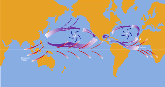
In 1565, Andrés de Urdaneta discovered the return trip from the East, which was a new route that passed northwards, thereby avoiding the much-feared and treacherous trade winds. This discovery was to allow communications to exist on a regular basis between the Philippines and New Spain.
In the “virreinato” a long overland trail known as the “Camino de los Virreyes” or Route of the Viceroys, connected the Atlantic city of Veracruz with the capital, and the capital was connected with the port of Acapulco on the Pacific coast by means of the “Camino de Asia” or Asia Route.
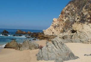
In 1851, Acapulco was authorized to carry out trading activities with the Orient and became a place of privilege in the links established with the Asiatic archipelago. It was to maintain this role during the lifetime of the Viceroyalty.
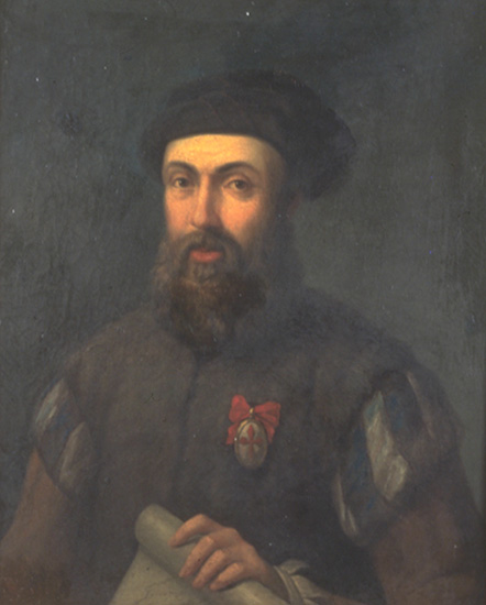
Magellan, a Portuguese navigator serving the Spanish Crown, discovered the Philippine archipelago during his search for the spice route which, of necessity, had to avoid any contact with the Portuguese possessions.
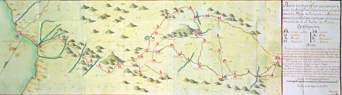
Colonizers, friars and traders traveled the “Camino de los Virreyes” which linked Veracruz with the capital of New Spain.
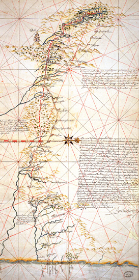
All travelers and merchandise landing in Veracruz and bound for the Philippines had to undertake a long overland journey before boarding the Acapulco Galleon.
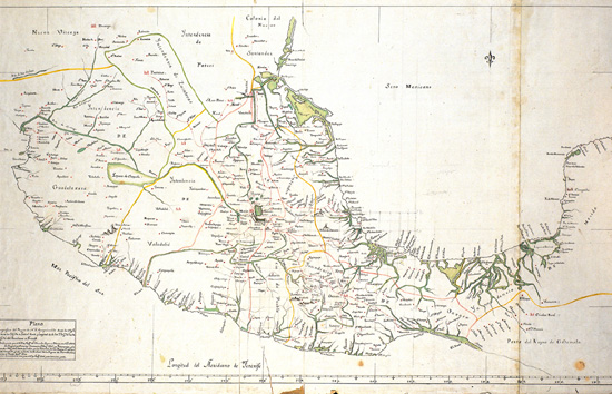
An interoceanic route linked Veracruz with Mexico; then, after following a descending route it reached the city of Acapulco on the Pacific coast.
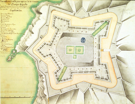
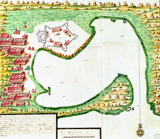
Works undertaken to fortify the city were intensified from the 18th century onwards, although difficulties were encountered in the transportation of materials and labour in this respect.
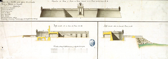
The military engineers took as long to find a technical solution for crossing the Mezcala river as they did to design the castle itself.
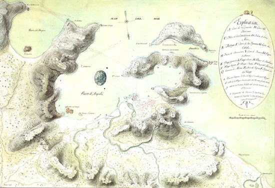
From the second half of the 18th century onwards, improved cartography of Acapulco Bay became available; before this it was practically impossible to draw up plans for adequate defences of this port.
The port of Acapulco became increasingly important as from 1565, when Andrés de Urdaneta, an Augustinian friar, discovered the route for the return voyage from the Philippines.
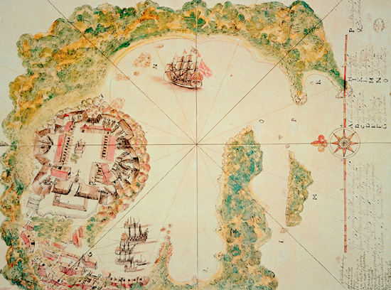
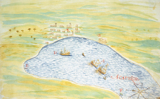
The arrival of the Galleon at the port of Acapulco was a very important event: it meant the opening of the market-place and transformed the usually quiet town into a city full of hustle and bustle.
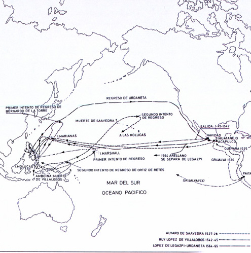
The first routes of the Pacific Ocean according to Morales Padrón
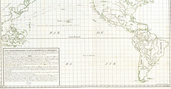
This shows the navigation route followed from Panama to the Philippine archipelago and the one used for the return voyage; it reflects the most up-dated observations and ocean routes established at the end of the 18th century.
Maritime power and colonization, the Indies run and the Philippines run.
The other pages on our site are:
- 1 The Longest Transoceanic Route
- 2 Sailing On and On
- 3 Ships, Galleons, Frigates and Corvettes
- 4 Defending the Sea and the Land
- 5 The “Virreinato” of New Spain
- 6 The “Cuadrícula”