Below are selected articles and recipes from Baja California, Baja California Sur, Sinaloa and Sonora, the four states that form the North Pacific Region of Mexico.
To see ALL articles and recipes related to this region, please use the following individual state links:
- Baja California – Articles or Recipes
- Baja California Sur – Articles or Recipes
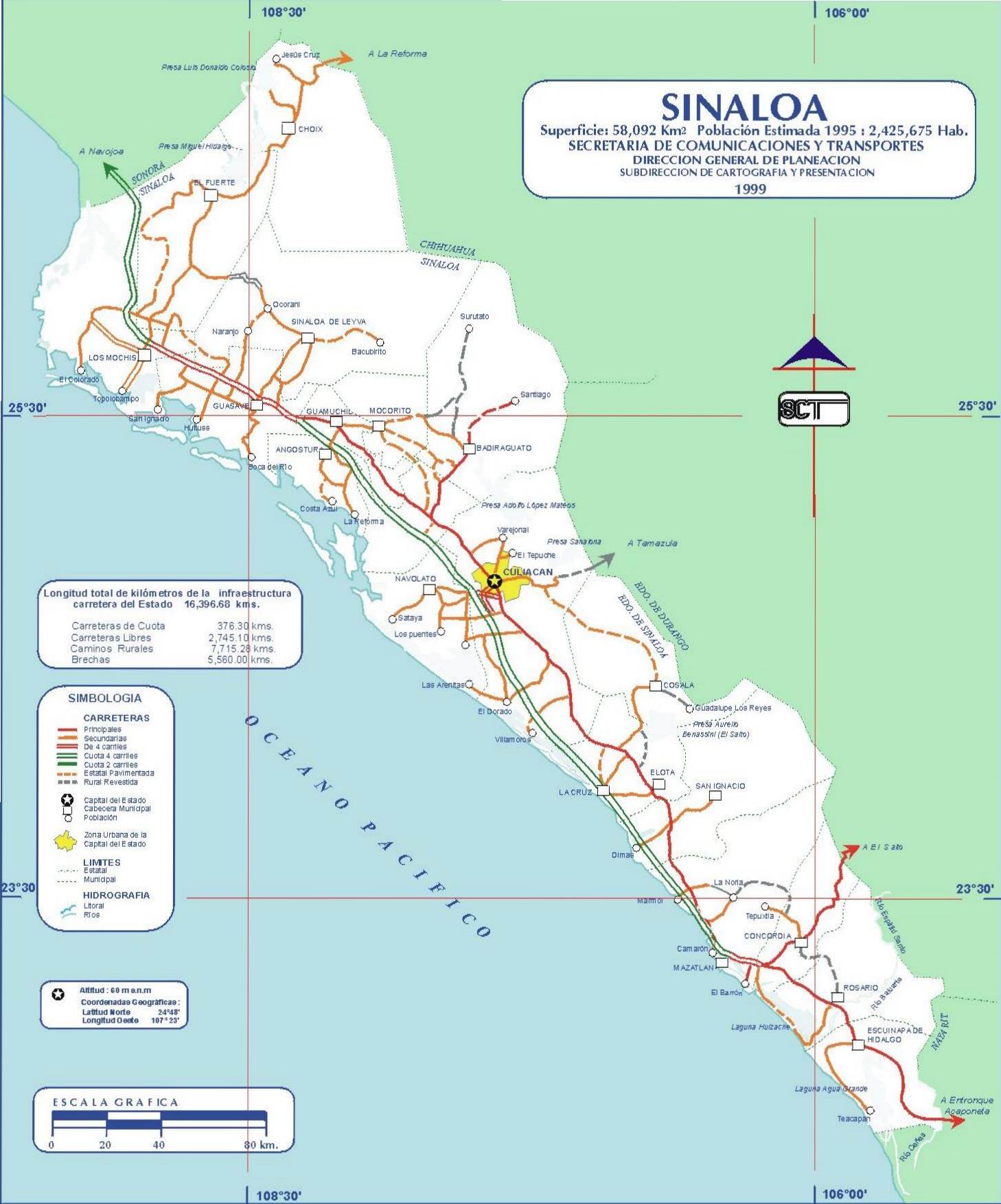
- Sinaloa – Articles or Recipes
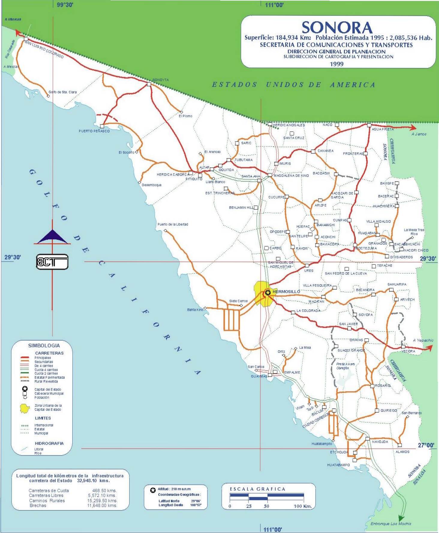
- Sonora – Articles or Recipes
The North Pacific Region includes the western foothills of the Western Sierra Madre (and Copper Canyon region), coastal lowlands bordering the Pacific Coast and the very arid peninsula of Baja California.
Here are select articles and recipes related to the North Pacific Region:
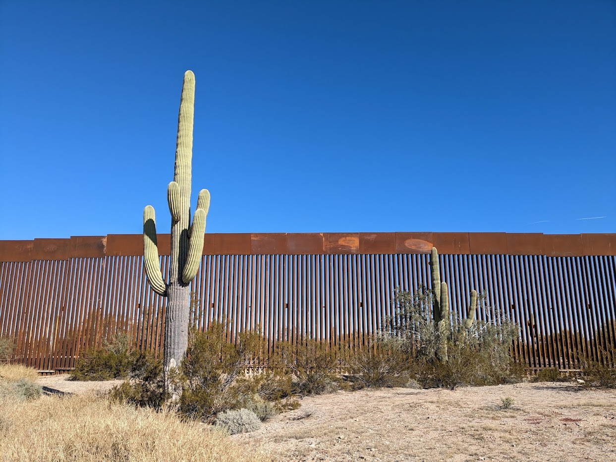
Motoring along Highway #2, the edge of Mexico
MexConnect.com is all about Mexico. While most articles focus on the interior, the edge of Mexico is still Mexico and Mexico’s border regions are worthy of exploration. There is plenty to see there. My 20-year old son Raphael and I recently took a drive in a Mexico border region. We followed the U.S.-Mexican border, on […]
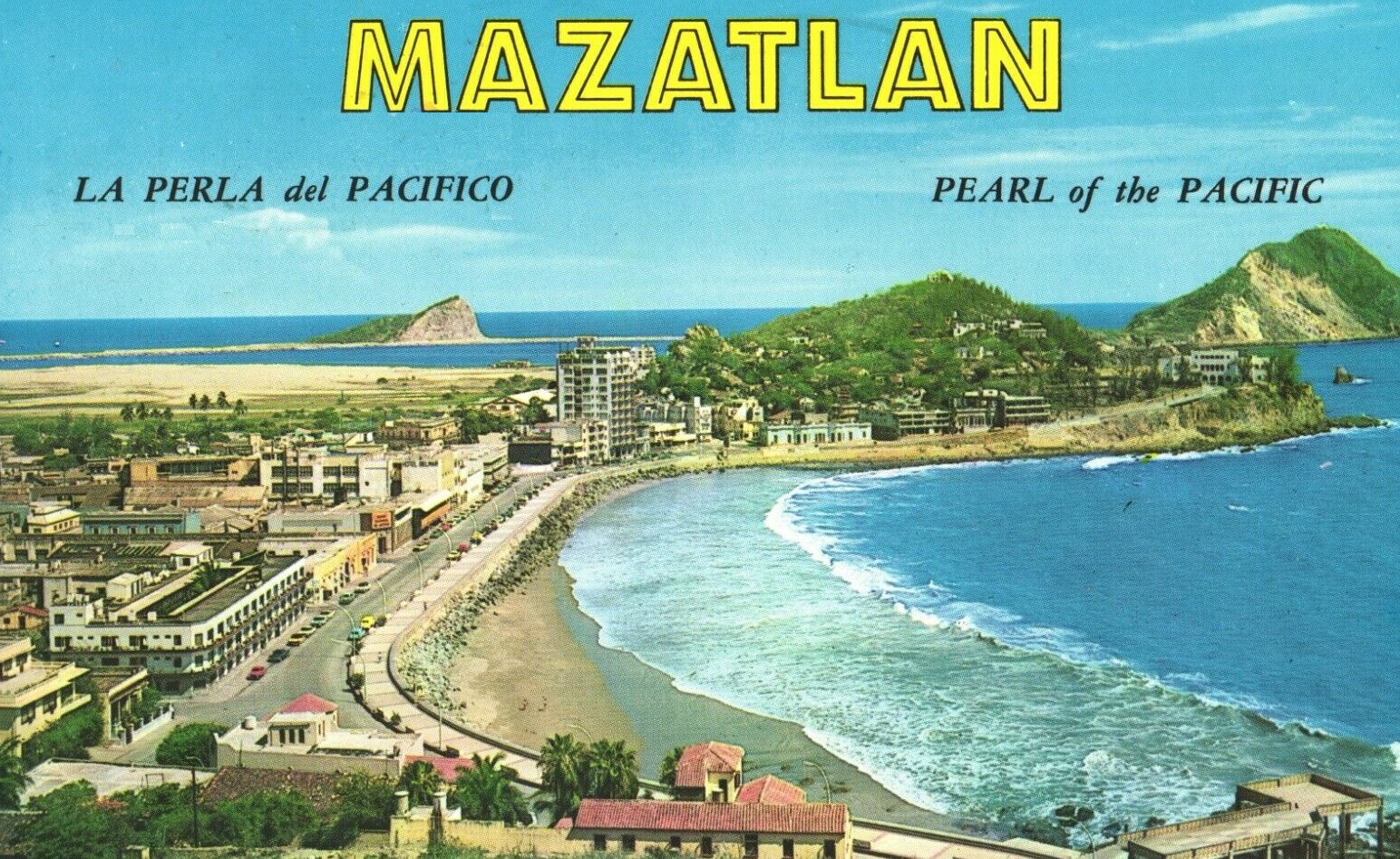
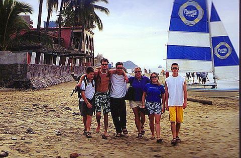
A family trip to Mazatlan—Sinaloa’s Pearl of the Pacific
La Perla del Pacífico-“The Pearl of the Pacific”. That’s what Mazatlán, Mexico, is called. Mazatlán is located in the state of Sinaloa, on Mexico’s Pacific coast, looking out across the water towards the tip of the Baja California peninsula. However, Mazatlán is not the only “Pearl of the Pacific.” At least 9 Latin American coastal […]

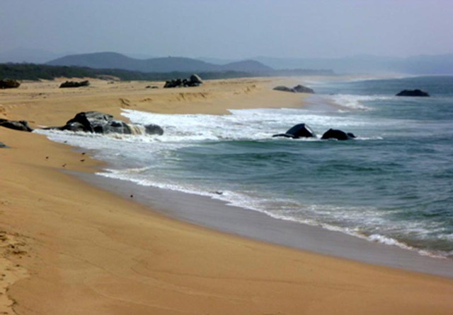
Solving the mystery of a lost Spanish galleon on Mexico’s Baja California Peninsula
When European ships were wrecked at sea, a Christian burial was usually afforded those whose bodies washed up on the shoreline. That was not the case here. Somewhere on a desolate stretch of a Baja California beach lie the bones and cargo of a once majestic Spanish galleon. It was around 1576 when she vanished […]
Mexican seven seas fish: Pescado siete mares
Mexican seven seas fish is a specialty of La Cenaduría, a lovely old adobe restaurant in San Jose del Cabo. It combines fresh red snapper filets, a mild salsa roja, and just enough manchego cheese to melt over the top. The description of the preparation that I was given mentioned only “red sauce;” since this […]
Shrimp in damiana and tequila sauce: Camarones al damiana y tequila
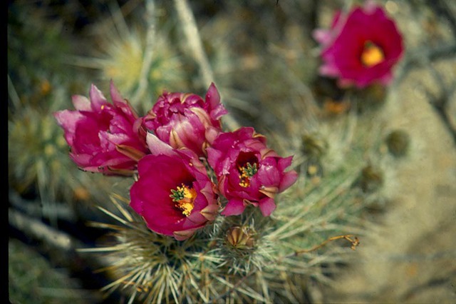
Damiana is a small, yellow flowered shrub that grows wild in Baja. The leaves and stems are picked fresh when the plant is flowering, and dried to make liqueur. It is used frequently with tequila, and some say that the original margarita was made with damiana liqueur and not “that French stuff.” The best damiana […]
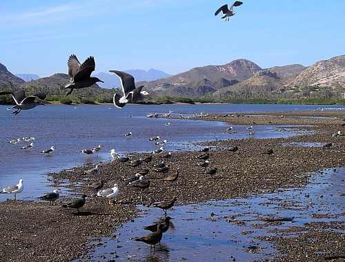
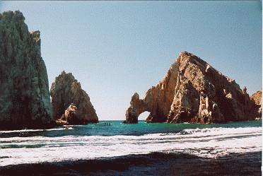
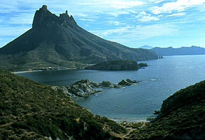
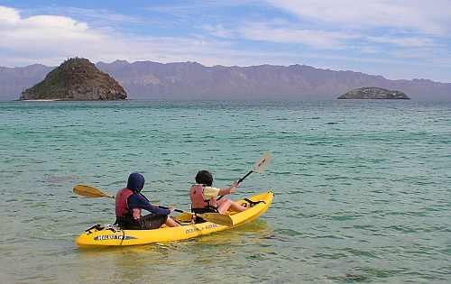
Oases on the Sea of Cortez
The rugged Baja California peninsula and the Sea of Cortez, or Gulf of California, have been bewitching hardy visitors for decades. Some of the early fans were John Steinbeck and Earl Stanley Gardner, who took time out from Perry Mason to produce a magnificent photo book on the Sea of Cortez and its villages. Until […]
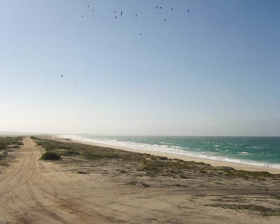
Johnny’s Beach on Baja’s Golfo de Santa Clara
“If you’ve ever traveled the mainland side of the Sea of Cortez, just south of the town of El Golfo de Santa Clara, you may have had lunch at a beach restaurant called “Johnny’s Place,” which is located on a long stretch of sand known as “Johnny’s Beach.” You might have wondered about the name; […]
Filet mignon with tomatillo-chipotle sauce: Filete de res al chipotle
The colonial silver mining town of Alamos, Sonora was designed by the king of Spain’s personnal architect and remains every bit as impressive today as it was three hundred years ago. While staying at Alamos’ beautiful Hacienda de los Santos, I taught a cooking course which included this version of filet mignon in chipotle sauce. […]
Grilled Chihuahua style leg of lamb: Pierna de cordero a la parilla
This northern Mexican recipe, which typifies the outdoor cooking characteristic of the region, is adapted from Larousse de la Cocina Mexicana by Alicia Gironelli. One end of a leg of lamb is thicker than the other, going from about 1 – 2 ½ inches thick, making it easy to satisfy the different tastes for rare, medium and […]
North to Nogales from Puerto Vallarta (and back)
Two years ago, I would’ve been leery about driving out of Mexico alone. Well, “everyone says” that the drive to Nogales (from Puerto Vallarta) is a drag: long, flat, boring, and nothing to see – something like, “straight roads and lots of desert.” As is the usual case with “the CV” (the Conventional Wisdom), it […]
Mexican three milk cake with rompope: Pastel de tres leches con rompope
Tres leches cake, one of the all-time Mexican favorite desserts, is so named because it is made with three kinds of milk. Sweetened condensed milk has been around since the 1800s, when it was developed as a way of preserving milk, so this is not necessarily a modern recipe. This cake is usually made as a […]
Mexican fish cocktail: Ceviche
Originally from Peru, where it is generally made with corbina, ceviche is a seafood cocktail served anyplace in Mexico where fresh fish is available. It has been “mexicanized” by the addition of ingredients such as tomato, avocado and cilantro. It is important to use only the freshest fish, from unpolluted waters, to make ceviche. Since […]
Fish “Meatballs”: Albondigas de Pescado
A delicious and economical way to use just about any firm, white-fleshed fish, this is a common meal along Mexico’s Pacific coast, especially in Baja California and the Puerto Vallarta area. The albóndigas, served in the tomato broth, can also be made with leftover poached fish. Ingredients: For the albóndigas: 1 pound firm, white-fleshed fish filets, ground in […]
Sonora style beef stew: Guisado de res sonorense
Cooks in Sonora often cut the beef for this guisado into strips, so that it can be rolled into burritos once cooked. This way, the recipe yields a vegetable stew plus beef burritos. In Mexico, ground ancho chile is sold in most large mercados. North of the border, it is sold bottled by McCormick. Ingredients 1 pound flank steak, […]
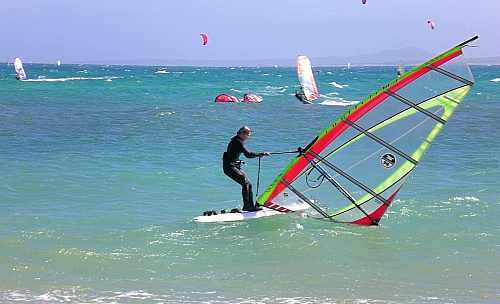
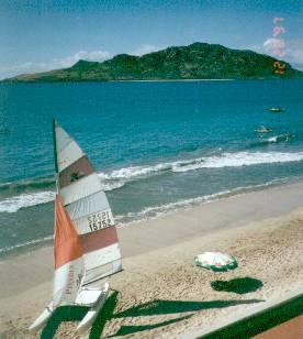
Baja California’s Sailing Safety Tips
Mexico’s prime cruising season is between November and June (once the hurricanes have stopped) and these are the favored times for sailing in Baja as well. Sailors do, however, warn of periodic strong winds from the north, northwest and east on Baja’s Pacific Coast. Some note that the Sea of Cortés can be dangerous from […]
Mexican fish tacos: Tacos de pescado
Perhaps the most famous Baja street snack, and certainly one of the most frequent reader requests, fish tacos differ a bit from place to place, but are always served with the same basic selection of garnishes. A thin avocado sauce, vinegar-marinated onion rings, shredded cabbage salad, and a selection of red and green salsas are […]
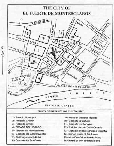
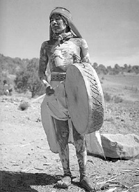
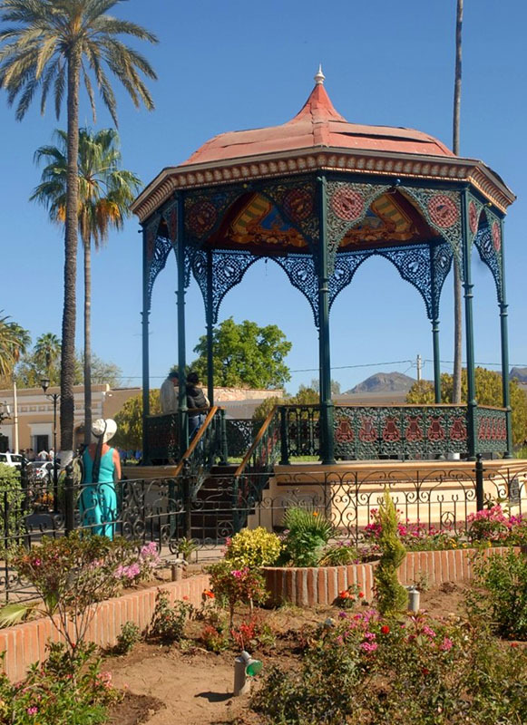
El Fuerte in Sinaloa, Mexico, was once the capital of Arizona
Prior to the founding of San Juan de Carapoa (later renamed El Fuerte de Montesclaros) by Francisco de Ibarra in 1564, relatively little is known of the early Indian peoples living in the Fuerte valley. They probably harvested wild plants, farmed small gardens, fished and hunted for their survival. They appear to have had few […]
Ferries in Mexico: the Pacific coast 2009 update
For many travelers, driving down the Baja Peninsula, taking a passenger/vehicle ferry across to Mexico’s mainland and then exploring the interior is a pleasant way of experiencing a wide variety of topography. This Page provides basic ferry information to assist travel in either direction. Reservations are recommended any time of year. Many prefer to make […]
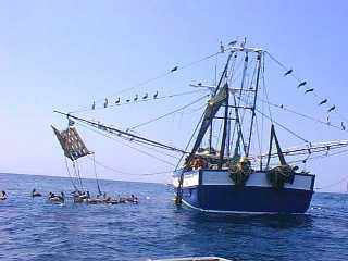
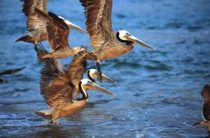
Overfishing in the Sea of Cortez: Are sustainable fish farms the solution?
It is occurring at an alarming rate — native populations of fish, mammals and other Sea of Cortez (or Gulf of California) inhabitants are declining, some to the point of near-extinction. Most people familiar with the issue agree on the reasons: commercial overfishing; bycatch victims of all species in commercial and local fishermen’s nets; environmental […]

Retiring And Living Around Tijuana
Posted by Mack on Abril 24, 2000 I’m looking for information on living in Tijuana or nearby for the winter moths at first. Need any info I can get please. Rents ….whatever. Thank you Posted by alex in TJ on Abril 24, 2000 There are two nice areas of Tijuana. Playas de Tijuana is the […]

The cuisine of Sinaloa: Cenadurias in Mazatlan serve caldo and conversation
During the day visitors come down the long entranceway that gives this restaurant its name, asking if it is open. Despite the sign at the entrance to El Tunel, showing the opening time 5:30 p.m. they come and ask, and they promise to return in the evening. Neighbors, too, come throughout the day. […]
Headin’ South to Guadalajara from Nogales
Charlie G. Posted by Charlie G. on January 13, 1999 Headin’ South from Nogales (an update) My son and I crossed the border at Nogales yesterday (1/11) and were pleasantly surprised with the efficient system we found at the Mexican immigration and customs station on the loop west of Nogales about 19 miles below the […]
Baja stuffed clams: Almejas brujas
Many varieties of clams are to be found in the Sea of Cortez, including the famous chocolates and patas de mula. For this Mexican stuffed clams recipe, we used the large, yellow-shelled botijones, which have a long, firm white foot, although any type of large, hard-shelled clam may be used. Clams should be soaked in […]
La Paz, Baja California Sur
For a city named Peace, it has a rather grim history. A Spanish expedition sailed into the bay in 1533; the leader and several of his soldiers were killed by the indigenous residents soon after, by some accounts because they raped the native women. Hernan Cortes arrived two years later looking for pearls (he found […]
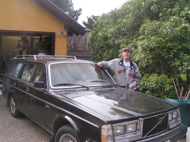
Surviving a highway accident in Mexico
This was intended to be a straightforward article on driving to Nogales from Guadalajara and back, with information on tolls, distances, hotels, restaurants, etc. However, a young Chicano in a brand new truck changed all that on our return journey. Hence, the use of the word “accident” in the title of this piece. Our little […]

Twilight on the Line: Underworlds and Politics at the U.S. – Mexico Border by Sebastian Rotella Norton
Cogan’s Reviews “The action never stops at the border. There is no other place like it on the globe. The international boundary stretches for almost two thousand miles, from the Pacific Ocean through the mountains, the deserts, the valleys of the Rio Grande to the Gulf of Mexico. The region is a vast world unto […]
Almost an Island: Travels in Baja California by Bruce Berger
Cogan’s Reviews The title of this travel book sounds a bit odd to us now. But the question of whether Baja California was an island was in doubt for a very long time. In fact, as late as 1737, a map was drawn by a German Jesuit that showed the peninsula as an island. Now, […]

Copper Canyon, Chihuahua, Mexico by Richard D. Fisher
Cogan’s Reviews I suspect this may turn out more like a travel article than a book review. In late March we took a tour through the length of the Copper Canyon and I find it difficult to know how to write about this book without bringing in various aspects of the Canyon trip itself. It […]
Miraculous Air: A Journey of a Thousand Miles through Baja California, the Other Mexico by C. M. Mayo
Cogan’s Reviews Most of us think of the Baja Peninsula as a vast, sprawling, empty, underpopulated space on the Pacific Coast with hundreds of miles of desolate beaches. To a great extent, that’s what it is. For many, it’s a place to avoid, except perhaps for the resorts on the extreme southern tip – Cabo […]

The Log from the Sea of Cortez by John Steinbeck
Cogan’s Reviews So far I haven’t managed to make it to the Baja. Hopefully that will be corrected in the next year or two as my wife and I work our way through the list of places we hope to visit in Mexico. However, while reading Steinbeck’s book, I found myself looking up various guidebooks […]
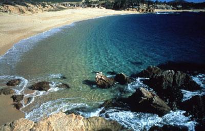
Puerto Vallarta versus Cabo Beaches
Posted by Tim Bowen on July 12, 1999 I am going on my honeymoon in 30 days, and I was told by someone who just returned that the beaches at Puerto Vallarta were not very nice to visit. I was told that the beaches were very pebbly and that there was dog crap and garbage […]

Mexico main event: Baja 1000 rerun on TV
If you missed the November excitement of the Baja 1000, you can see the December version, minus dust and exhaust fumes, on ABC or ESPN the day after Christmas. The world’s toughest motor vehicle race followed an 883-mile desert loop designed by the devil himself, out, up, down and around, across washes and over boulders, […]
Come on down to Cabo San Lucas
The wedding was an exciting reason to do Cabo San Lucas. Glamorous “Glee” star Naya Rivera and actor Ryan Dorsey were to take their vows. An area acquaintance, part-time bookie and fishing guide, said come on down, that my fame as a writer and his international influence could get us an invitation to the party […]

Mexican investigators may get bad rap
The reputation of Mexican criminal investigators is often somewhere below zero, except on this occasion. They don’t even hear about a lot of crimes. They seldom solve cases. Even when they think they have caught a crook, they rarely gain convictions. Judges shake their heads. Maybe the warrant was defective, wrong address, misspelled name. Or […]
Secret places in Mexico
As a child, I sometimes read comic books for entertainment. I did not believe in flying dragons but they certainly stimulated the imagination. As an old-timer, older than dirt, I read travel writers just for fun. I do believe some write at great length about Mexico without ever visiting. Case in point: Smarter Travel magazine […]

Sweet Spot: A novel about Mazatlan Carnival, Dirty Politics, and Baseball
Adoro Books, 2009 Available from Amazon Books: Paperback The back cover of Sweet Spot tells us that author “Linton Robinson was a journalist in Mazatlán and other Mexico cities for years. And played a little ball in his time.” His protagonist and narrator — Raymundo Carrasco — likewise was a journalist in Mexico for years. And played a […]
Traveler’s Guide to Camping Mexico’s Baja by Mike and Terry Church
Available from Amazon Books: Paperback A while ago, I reviewed for MexConnect another useful book by Mike & Terri Church: Traveler’s Guide to Mexican Camping, 3rd Edition. LINK That book — in 512 packed pages — covers all of Mexico, and even Belize. Eighty pages are devoted to the Baja. A few months before that, I reviewed another book […]
Driving Baja: A Guide for First Timers
Driving Baja: A Guide for First Timers By Rachel McMillen Trafford Publishing, 2009 Available from Trafford Books: Paperback Driving Baja: A Guide for First Timers tries to answer questions that first-time Snowbirds who are thinking about driving (perhaps with RVs) down the Baja are likely to ask: “…could we really do it? Is it safe to […]

I Love Baja!
I Love Baja! Pursuing the Dream of Living in Mexico By Mikel Miller Publisher: AdelanteBooks.com (Guadalajara, Jalisco, Mexico) Original eBook ©2011, updated eBook ©2015 Kindle Edition, $1.44 US Pages: Estimated 197 The title of Mikel Miller’s new book, I Love Baja!, was inspired by locals who again and again told him, “I love Baja!”. These same […]

Did You Know? The World’s first aerial bombing: the Battle of Topolobampo, Mexico
In the early years of the twentieth century, the nature of warfare changed dramatically. The deployment of aircraft unleashed a powerful new weapon for warring factions, previously forced to rely only on their land and sea forces. The earliest attempt to incorporate air power into fighting is thought to have been when an Italian pilot […]

US postage stamps and Tijuana, Mexico’s Seabiscuit connection
In 1934 during the depths of the Great Depression, horse trainer Tom Smith was living out of a stall at Mexico’s Agua Caliente racetrack in Tijuana. Flat broke, Smith shared the stall with Noble Threewit, who trained horses for a friend of Charles Howard. Howard was seeking a trainer for his new horse, Seabiscuit, a […]

Cejas and the great escape: Dog rescue in Tijuana
The mean streets of Tijuana have at last dispatched something other than media reports of killings, kidnappings and cartels. The bloody, dusty, bullet-ridden streets of Tijuana have wached Cejas emigrate, even without proper papers. You may be wondering, Who is this Cejas of whom she writes? Is he a Mexican hero? Is he a famous […]
Oasis of Stone: Visions of Baja California Sur
Although the Baja coast has attracted thousands of visitors, among them some fine photographers, few have really journeyed to the interior This exquisite coffee table book is a collaboration between two friends, both of whom are award-winning artists: photographer Miguel Angel de la Cueva and essayist (and poet and musician) Bruce Berger. Several books […]
Cabo Pulmo: from beaches and baskets to mines, music and marine park (part two)
To Part 1 Cabo Pulmo We arrive in Cabo Pulmo as the sun is setting, relieved to finally find the end of the initially paved, then dirt access road, which has been bounded by barbed wire ever since we caught our last clear views of the coast near La Ribera. At intervals behind the barbed […]
Part one – La Paz and El Triunfo: from beaches and baskets to mines, music and marine park
To Part 2 La Paz La Paz was almost unrecognizable. I’d enjoyed the small town atmosphere when I first visited it in 1980 but it now has the big city pretensions that I find far less appealing. Despite my reservations, the family enjoyed several days in La Paz in December 2007, wandering about the downtown […]
Cabo to Cabo
On my last visit to Cabo San Lucas in 1997, the city had installed its second traffic light four months ago. It stands on the northwestern outskirts of town, where Mexico Hwy. 19 begins its winding journey to Todos Santos, 45 miles away. So far no one had bothered to turn it on, but I […]
Sweet And Sour Times On The Border
Less than 500 metres south of the U.S. border, in front of a ochre-stuccoed shopfront signed ‘Café Nueva Asia’, a technicolor banner of the Virgin of Guadalupe hangs side by side with a red paper lamp bearing Chinese characters. Although nearly three months have elapsed between the Feast Day of Guadalupe and Chinese New Year, […]
All saints adrift in Todos Santos
Todos Santos is a place people disappear to. Something about the layout — the way the single two-lane highway through town can take in casual visitors at one end and dispense with them at the other end without revealing too much — keeps the profile relatively low, especially considering Cabo San Lucas is only an […]
Beach-bumming it in Mazatlan
Crooked under one arm, he lovingly hugs a water-beaten body board as if it were his best friend. A mass of dirty blonde dreadlocks crowns his scalp and from under sun-faded Hawaiian shorts, his bronzed muscular body depicts a carefree, beach bum lifestyle. He bids us a “G’day, mates,” and I have to remind myself […]
Mazatlan – not just another resort
Angela Peralta is a big name in Mazatlán (mah-saht-LAHN). And practically everyone, especially the locals, are happy to tell you “the real story” about this legendary, Mexican diva. Only every story you hear is different. So after a lot of research, here’s the authentic saga of Angela Peralta. So they say: When Angela Peralta, lovingly […]

Introducing Rick Gage: Murder in La Paz and Death Mask of the Jaguar by Murdoch Hughes
Cogan’s Reviews With these two thrillers we find ourselves in the world of hard-boiled private eyes – a la Dashiell Hammett and Raymond Chandler – but with a difference. Both stories are squarely set in Mexico. Murdoch Hughes has created a private eye, Rick Gage, who has given up his former career as a detective […]
Mexico’s Copper Canyon
For an unusual winter break, how about a Mexican train ride? The Reader’s Digest called Mexico’s famous Copper Canyon railroad trip, “the most dramatic train ride in the western hemisphere”. Even that description fails to do justice to the spectacular scenery and sightseeing along the line. The railroad was originally built to give southern Texas […]
Loreto Bay: The greenest place in Baja, and quite possibly in all of Mexico!
Loreto Bay, a 3-billion-dollar, 6,000-home development in Baja California Sur, may be the most eco- and socially-aware resort project anywhere in the country. At first sight, this is rather strange, given that Loreto Bay, eight kilometers (five miles) south of the town of Loreto, was originally conceived by the Mexican Tourism Development Agency, Fonatur, which […]

Loreto and San Javier: from sun, sand and snorkeling to museums, missions and mountains
Three towns in Baja California Sur offer a relaxing alternative to the frenetic pace of life in the pricier and more touristy Los Cabos area: Loreto, Mulegé and Santa Rosalía are very different to one another, and all well worth visiting. This is a trip that combines some sun, sand and snorkeling with some museums, […]
Easy living in Mazatlan, the Pearl of the Pacific
Recently, a number of books, magazine articles, web sites and Internet forums have begun to include discussions among surprisingly large numbers of Americans and Canadians about the possibility of retiring in Mexico. When specific locations are discussed, a few areas seem to dominate the conversations, specifically those areas where sizable “enclaves” of North American retirees […]
Tijuana: a taste of Mexico on a budget
Tijuana: A Taste of Mexico Part I: While white sand beaches and lobster by candlelight are part of a typical vacation for many tourists, I’ve never been much interested in the overpriced and frankly elitist form of pastime that this sort of vacation offers. I’m more of a working stiff who likes to wander the […]

Tijuana hotels and dining
People in Latin countries are usually out visiting in the evenings, having fun and listening to street musicians and eating at any of the well-lit taco stands on the corners. Tijuana: part II: A good meal to round out my day… and a place to lay my head at night Dining Out I like a […]

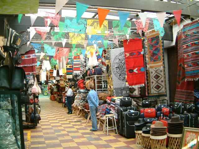
Tijuana: Serious shopping for the serious shopper
Tijuana: A Taste of Mexico Part III: Recently we have heard and read much of “outsourcing” in economic terms. And it’s true that by the large-scale outsourcing of services and manufacturing, we are incrementally destroying our own economy. But the key is the term “large-scale,” since only the larger losses truly affect a local economy. […]
Viva La Baja! Relocation and Real Estate Guide to the Baja California Peninsula by Molly McHugh
Molly McHugh’s recently published Viva La Baja! Relocation and Real Estate Guide to the Baja California Peninsula provides concise, easy to use information for anyone interested in north or south Baja. It is obvious that McHugh’s objective is to provide an excellent product that will be useful for people of all ages and from all walks […]
La Paz, Baja California Sur: A practical guide
Our trip started with the idea that we had not been to Mexico for a while, so it was time to get our Mexico fix. Our plan was a one week get away to a Mexican beach, using our frequent flier miles. The airline reservation desk was somewhat confused when we told them that we […]
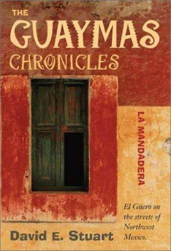
The Guaymas Chronicles: La Mandadera by David E. Stuart
Cogan’s Reviews Although it’s about Mexico, this one starts off in Ecuador in the 1960s where the author was doing doctoral fieldwork for a dissertation on haciendas in that country. His work took him to a remote research station on the side of a mountain seventy miles from electricity, running water, telephones, etc. One day […]

The Devil’s Highway: A True Story by Luis Alberto Urrea
Cogan’s Reviews This is the story of a group of men who have become known as the Yuma 14. They are the fourteen illegal immigrants who died attempting to cross the Arizona border in May, 2001. And what a terrible and upsetting story it is. Unknown numbers of these illegal immigrants die every year making […]
Sonora – Mexico’s wild west
During the heyday of westerns, films showed cowboys riding through the Great Sonoran Desert from Arizona to what is now the State of Sonora in Mexico. The desert is still there and so are the cowboys. Sonora is Mexico’s wild west. In some ways, it reflects the Old Mexico of the by-gone days of yesteryear. […]
Life goes on in Todos Santos despite the changes
Down narrow, winding, desert Highway 19, an hour past the last golf course in Cabo San Lucas, lies quiet Todos Santos, a Mexican hamlet with just over 3,400 residents, on the Pacific side of southern Baja California. Here, it’s not what you see but what you don’t see. Life goes on behind pastel walls. As […]
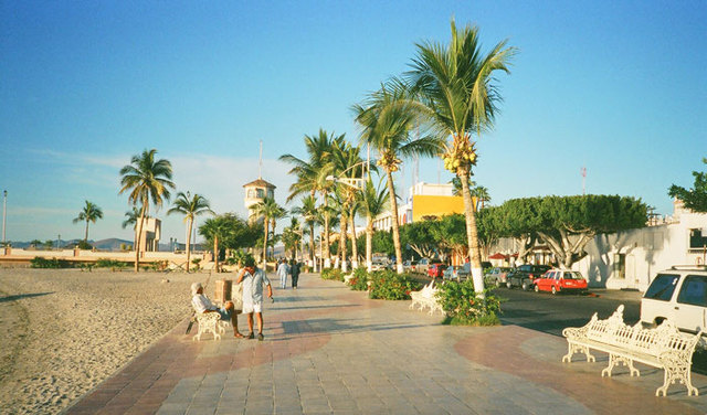
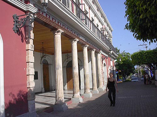
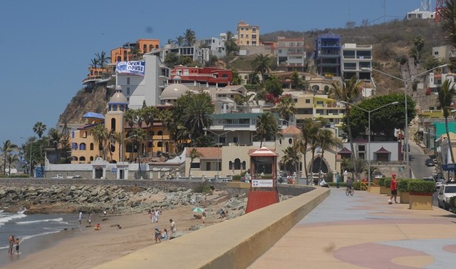
Old Mazatlan has its charms
At first glance, Mazatlán looks like a typical Mexican beach resort with boxy high-rise hotels and loud nightclubs crowding its shoreline, but there is more to this old port city than meets the eye. To discover the historic town behind the resort, you have to leave Mazatlán’s tourist zone, known as the Zona Dorada or “Golden Zone,” […]
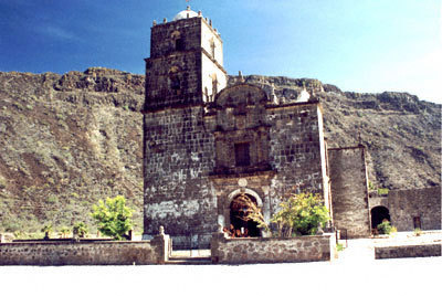
Baja California Sur side trip: Mision San Javier
The biggest attraction on my most recent Baja to-do list was a visit to Mission San Francisco Javier De Vigge-Biundo, or simply, San Javier. Located via a 2.5 hr drive from Loreto, BCS, this mission is well worth the trip. Founded in 1699, this mission is the best-preserved in Baja. I was surprised to find […]
Mazatlan: why snowbirds keep coming back
Taxis to and from the airport run around $34 for the hotel zone and around $30 for centro. Be sure to write down your hotel name and address, in case your driver is unfamiliar with the place (or your pronunciation of it). During the day, buses are an excellent means to see the city and […]

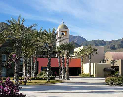
Living well at the Hacienda Beach Club & Residences
There is no buzzing lobby. No long formidable hotel desk. No jostling line of people waiting to check in and out. Instead, there is the Hacienda’s Concierge desk, set in the open-air reception terrace, amidst stunning Old Mexico architecture and looking out on the almost unbelievably beautiful azure waters of the Sea of Cortez. And, […]
Cooking on the Sea of Cortez: Culinary adventures in Baja California
Mexico’s Sea of Cortez, also known by the less lyrical name Gulf of California, supports more marine life than any other body of water on earth. It is no surprise, therefore, that divers, fishermen, and seafood lovers from all over the world find the Mar de Cortez an alluring and gracious host. Like an enormous […]

Did You Know? The oldest ballgame in the Americas
Baseball is not the oldest ballgame in the Americas Forget modern “traditions” like the World Series! Forget soccer, tennis and golf! By far the oldest ballgame in the Americas is the little known game of Ulama! Amazingly, this game is still played in some regions of Mexico, where it is believed to have originated more […]
Alamos: Still a boom to bust town, but with everlasting charm
There is magic in the wind and change in the air. The historic pueblo of Alamos, Sonora, like most Mexican silver towns, has descended to bust from boom more than once in its fitful existence. As long-suffering as a campesino, the community nevertheless has survived those roller coaster rides. Craggy hills clad in variable foliage […]
Mazatlan: Tequila, tans and working stiffs
Mazatlan has the virtues and vices of any tourist destination. But all the bad stuff – or good, depending on how you plan to spend the evening – is buffered by the decency and solidity of a working town. Unlike the hotel cities dreamed up by governments beholden to tourist dollars, Mazatlan, the second city […]
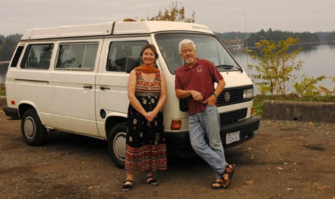
Nogales, here we come
It is more than Mexico’s constant sun and the bewitching landscape that entrance us. It is the people. October is revival month. We are at the tag end of six months in Canada the province of British Columbia to be precise — and joyfully are getting organized for the trip south to Mexico where the […]

Border disorder: passages into Mexico
I tell my friends that the only thing I have had stolen by Mexicans was my unwavering fealty to Canada: I have even considered living full-time in Mexico. We are approaching the border crossing about half a mile off. There are no distinctive markings to the terrain to define it. There is no checkpoint. No […]
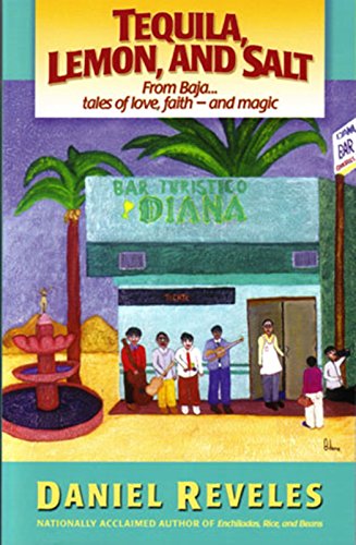
Tequila, Lemon and Salt: From Baja – Tales of Love, Faith and Magic by Daniel Reveles
Cogan’s Reviews The location for these nine stories is the town of Tecate in the Baja. I must admit I’d never heard of it until I came across this book. It sounds like a mildly attractive place, located 34 miles east of Tijuana. Tucked away in the extreme northwest of Mexico, it couldn’t possibly be […]
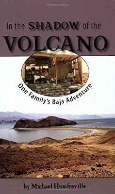
In the Shadow of the Volcano: One Family’s Baja Adventure by Michael Humfreville
Cogan’s Reviews This one is a little different from your usual travel adventure in that the people involved set out with the definite intention of “roughing it.” And they seem such an unlikely pair. They are Michael Humfreville and his newly-wed wife, Mary Ann. The two were married in California in 1973. Both were employees […]
Baja California Sur – Overview
LOCATION: The state of Baja California Sur is located in northeastern Mexico, on the peninsula of Baja California. It is bordered to the north by the state of Baja California Norte, to the west by the Pacific Ocean, and to the south and east by the Gulf of California, also known as the Sea of […]
Did you know? Los Mochis and Topolobampo are both examples of “new towns”
The city of Los Mochis (“Mochees”, as locals call it) in the northern state of Sinaloa, is one of Mexico’s newest cities. It dates back only as far as 1872, when a U.S. engineer, Albert Kimsey Owen (1847-1916) arrived. Owen envisaged the city as a U.S. colony centered on sugar-cane production in this previously unsettled […]
Living/Crossing Tijuana/San Diego
Posted by alex in TJ on Mayo 02, 2000 HOUSING: There are two nice areas of Tijuana. Playas de Tijuana is the little strip between the Ensenada toll road and the ocean. The other is near the American Consulate north of Aguas Calientes and is more centrally located. Rents run $350 to $400 per month, so […]

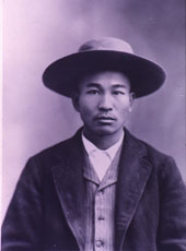
Did You Know? The Hero of Nacozari
The small town of Nacozari occupies a valley nestled in the foothills of the Western Sierra Madre (Sierra Madre Occidental) in the state of Sonora. A hundred years ago this month, a young locomotive driver had to make a desperate decision: save his own life or try to save the lives of hundreds in his […]
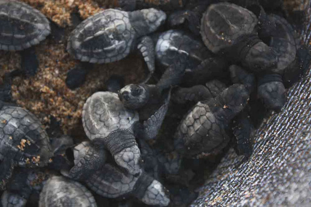
Rescuing and releasing sea turtle hatchlings in Todos Santos, Mexico
The sun is setting off the coast of Todos Santos, Baja California Sur and, even though we are in the tropics, we are bundled up in heavy, hooded sweatshirts and jeans to protect us from the damp, chilly evening air. Rough waves from the Pacific Ocean crash against the beach on this side of the […]
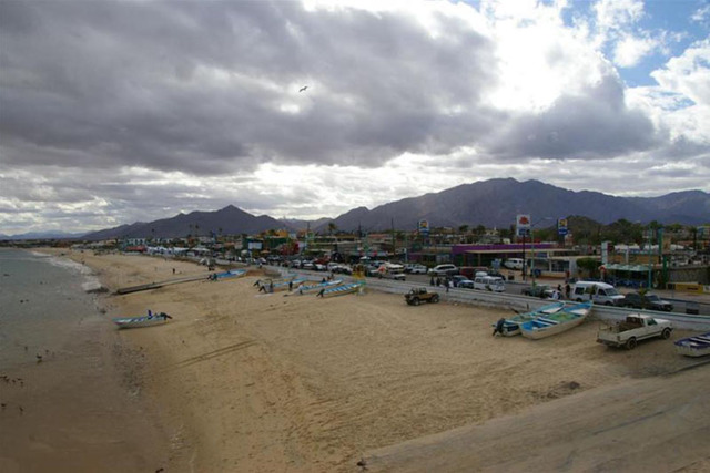
San Felipe: Baja California life on Mexico’s Sea of Cortez
I had dreamed about moving to Mexico for decades. As retirement approached, I began to look seriously at places to check out. Having lived in San Diego for decades, going to Mexico along the Baja California coastline was never a problem for me. I had an aging Mother who would be joining me, so nearby […]
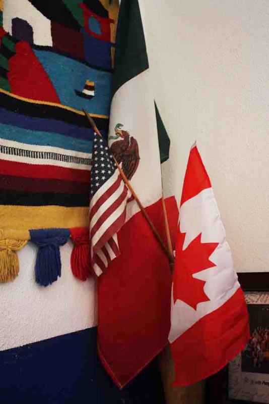
Liga MAC: Mexicans, Americans and Canadians join forces in San Jose del Cabo
The aroma of chicken over a mesquite grill fills the air on one of San Jose del Cabo’s backstreets. Noisy dogs chase each other playfully down dusty, dirt roads nearby. Cheerful mariachi music flows from dimly lit cantinas. There are no five-star restaurants here, no trendy nightclubs, no exotic resorts; not on this side of […]
Crossing to Tijuana: The Blue Line
The people waiting at the Civic Center either went to get someone out of jail or take the train to the US-Mexico border. That was life, dia y noche in San Diego and the most charming way to enter Mexico, via Tijuana. Immediately after 2nd Ave. the Blue Line: San Ysidro-Tijuana, ran in both directions. That was […]

Mexico real estate: Beach bargains in Baja
I looked at him with what could only be described as pure skepticism. “Affordable, direct ocean view Mexico real estate and just steps from the beach?” I said. “Show me.” As realtor and expat Max Katz drove me to a beachside community of Las Gaviotas on Rosarito Beach in Baja, Mexico, I imagined myself once […]
In Mexico, Baja beckons expats
Married, single, young, old, with kids in tow, retired or entrepreneurs — Baja Mexico is enticing expats with its promise of a better lifestyle. The choices are unlimited. The colorful culture of colonial and fishing towns, low home prices, world-class surfing on the crashing waves of the Pacific, snorkeling in the crystalline fish-rich waters of […]
Mexico’s San Felipe: A living desert museum
San Felipe is the center of a living museum that has witnessed the passage of a continuum of men, women and children for the past 2- to 3,000 years. Whereas evidence of their existence remains in most of the canyons draining the nearby Sierra San Pedro Martir, it stands in abundance in shell mounds lining […]
Mexico’s Copper Canyon spans Chihuahua and Sinaloa: introduction and resources
The most common way to visit Copper Canyon is by train, which runs from Los Mochis to Chihuahua – one of the few remaining passenger trains in Mexico. While this rail trip offers spectacular views, passengers do not get an opportunity to go deep into the canyon. Therefore, a few years ago, I opted to […]
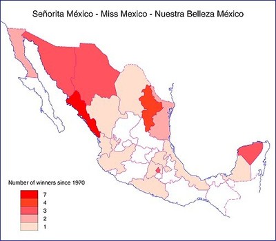
Did You Know? Sinaloa has the most beautiful women in Mexico
A chance remark recently by Mexico Connect publisher David McLaughlin has prompted me to examine the statistics on Mexican beauty. As a single, footloose and fancy-free, 20-something-year-old in Mexico City in the 1980s, I often heard that the most beautiful women in Mexico came from the state of Sinaloa. While I’m not confessing to having […]
The cuisines of Northern Mexico: La cocina norteña
Living in southern Mexico and making frequent trips to visit family and friends north of the border, we have taken many different routes to the frontera. From Tamaulipas, which connects the tropical south to the northern plains, to Sonora, where the vistas range from colonial towns to picture-perfect cowboy country, we have enjoyed all of our travels […]
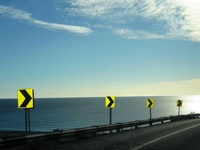
Driving the Baja Highway
The Baja 1,000 is considered one of the most dangerous, but exciting, races in the world. It winds through mountains and desert in the most remote parts of Baja California with drivers dodging Mother Nature’s homespun hazards like rugged dry washes and rapid changes in altitude. They also deal with free-roaming livestock, rattlesnakes and one […]
North of Loreto: Mulege and Santa Rosalía, sun, beaches, hotels and history
Mulegé North of Loreto, the highway leaves the coast until about half way to Mulegé, at which point the Bahía de Concepción (Conception Bay) suddenly comes into view. This next stretch of coastline is among the most attractive in all Baja. As the highway winds along the coast, a succession of protected bays, small coves, […]
Did you know? Mexico was once the world’s major source of pearls
This month’s Did You Know column highlights the pearl, the beautiful birthstone associated with the month of June. The history of pearl collecting in Mexico goes back a very long way. When Spanish explorers sailed into the Sea of Cortés (Gulf of California) in the early 1530s they encountered Pericú Indians wearing necklaces strung with red […]
Baja California – Ensenada and Tijuana
The word baja (meaning lower in Spanish) has come to be synonymous with the rugged, arid landscape of the Mexican state of Baja California. Its proximity to alta (upper) California, once Mexican territory but now a state in the United States, has made its gateway, Tijuana, the most visited city in Mexico. There competition dictates that one should […]
Ensenada Info
Posted by Rafa Gonzalez on Julio 04, 2000 Hello, My name is Rafael Gonzalez, I currently live in San Diego, CA and Pili Trabado is my sister in law. By her request I will try to give you some information about Ensenada, Baja. I lived there for a great part of my life and I […]
A Tijuana Jail
This is another vignette of one of my experiences in Mexico. It is not a complaint or criticism, just an account of brief adventure. A lot of people would be reluctant to admit that they had spent three days in jail. Who hasn’t violated a traffic regulation or fudged on their income tax. The ironic […]
Baja California – The Wedding
I rented a small house in La Gloria, in the hills between Rosarito Beach and Tijuana. It was a cozy place. I had painted inside and out and landscaped the yard. A willow tree shaded the back patio and there were a couple more trees. The architectural design was pretty neat and there was a […]
Baja California – Hotel Playas Ensenada
Doors are locked. Lights extinguished. The world belongs to the nocturnal creatures, the ocean, the breeze, and a trickle of night people. Time is irrelevant. The past, the present, and the future assume the same dimension. Men in tuxedos. Trousers rolled up and shoes cast aside. Ladies in fashionable evening dresses, held up to their […]