Hola! Welcome to MexConnect, the world’s largest content website about Mexico.
You have reached this page through an out-dated link.
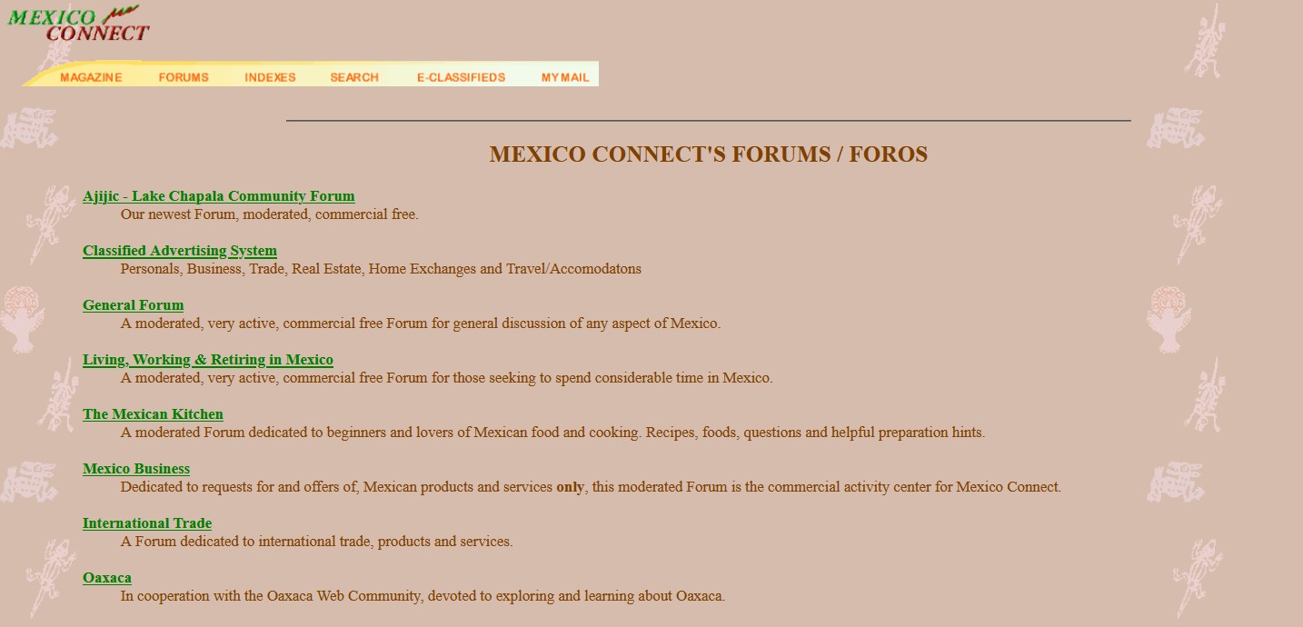
The world famous MexConnect forums (1996-2019) have been archived and are no longer being updated. To access read-only versions of the entire forums (200,000 posts in 30,000 threads), please try the following link:
The MexConenct forums were among the earliest interactive discussion boards on the web. Under the overall direction of MexConnect founder David McLaughlin, all threads and comments were moderated by a team of Mexico experts (including the incomparable Rolly Brook, Cristina Potters and many others) who helped guide discussions to stay on track (more or less). Our experienced moderators helped ensure that comments on the forum were as polite, inclusive and useful as possible for our many readers.
The rise of mass social media, such as Facebook et al., eventually provided alternative ways to share, discuss and distribute information, even if we old-timers can only lament the almost complete lack of any reliable content moderation or fact-checking.
Here we have archived some of the more interesting, useful, and/or popular posts from our old forums. Please note that information in these threads may no longer be entirely up-to-date. The full list of saved threads is available by clicking here: Forum Archives
As a preview, here are some of the available saved threads:
ana, July 2, 2002: what does it mean when someone asks “A que hora sale el pan”? I heard this in an interview and wasn’t sure what it meant. I understand the literal translation but I’m sure that’s not what they are really asking. Thanks. Jim en Cancún, July 2, 2002: ¿A que hora sale […] Posted by Soren on January 26, 1998 I am curious about this place. I have heard it described in relation to the gringos at least, as a rather bitchy art colony but students come and go. What is the nature of the more permanent expat community?? Can any help? Regards, Soren Posted by geri on […] Posted by Lee Harrison on Junio 17, 2000 I’ve recently returned from my second trip to Xalapa, and thought I’d share a few thoughts about the area, and my opinion of its suitability as a retirement location. Xalapa is a big place, with over 600,000 folks in residence. It’s pronounced “ha-LA-pa” (sometimes spelled Jalapa) and […]What does it mean when someone asks “A que hora sale el pan”?
About San Miguel
Xalapa – A report
To access the Home Page of the new MexConnect website, please use this link:
The main sections of MexConnect website are:
- Culture and Arts
- Food and Cuisine
- History and People
- Living, Working and Retiring
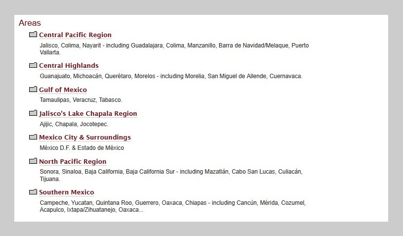
- Travel and Destinations
Welcome to MexConnect – please explore our site and enjoy!
Saludos,
Your friends at MexConnect, the world’s largest content website about Mexico.