If Lake Chapala could speak for itself,
Mark Twain’s famous comment might come to mind:
“The reports of my death are greatly exaggerated.”
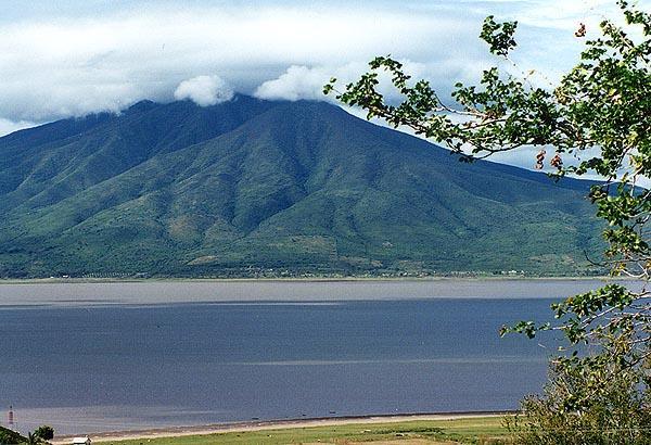
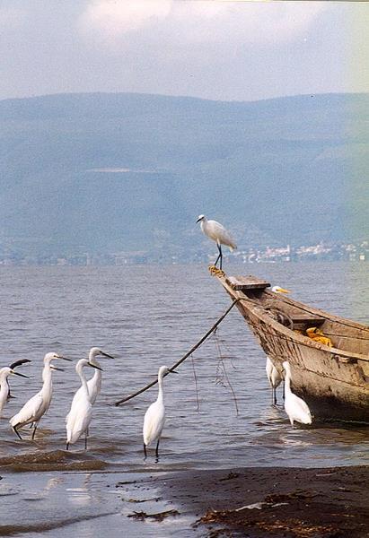
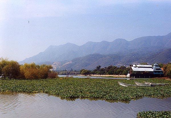
Since torrential rains began battering much of central Mexico in mid-August, the nation’s largest lake has undergone a truly astonishing transformation. Tourists boats that were forced to dock over a kilometer away from Chapala’s landlocked pier back in June now bob and pitch at the foot of its landmark lighthouse. Water once again laps against the muelles at Scorpion Island, Ajijic, Mezcala and other Ribera communities. Thousands of acres of empty lake bed terrain that had been gradually fenced off as farm land or converted to public or private playgrounds of various sorts, once again rest beneath a growing mantle of water and lirio (water hyacinths). These are scenes not witnessed since the mid-1990s.
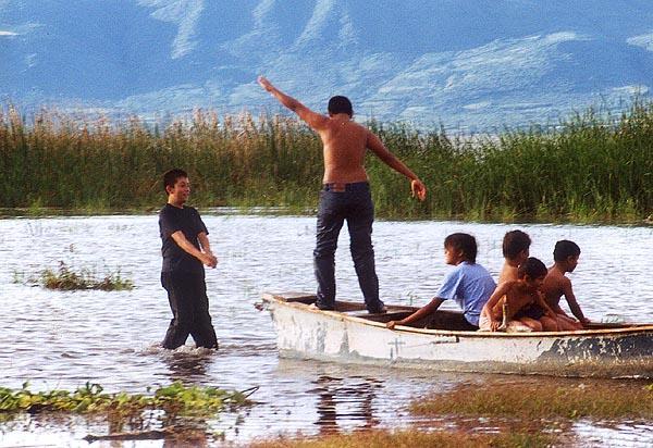
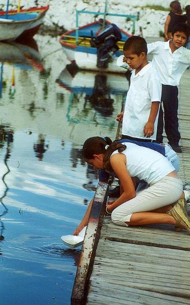
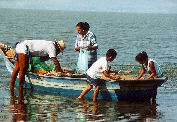
As news of the lake’s recovery has spread, day-trippers and week-enders from nearby Guadalajara and points beyond have flocked to the area, reviving not just the long-stagnant tourist trade, but business as a whole. A Chapala street merchant who once sold 1,000 coconuts per year reports moving that same amount on a recent weekend. An island restaurateur is now serving ten times the average number of Sunday diners as he was accustomed to. Sales have multiplied for produce and butcher stands in the city market, soft drink and beer outlets, and the candy, fruit and souvenir vendors who ply their goods along Chapala’s thoroughfares.
After years of watching helplessly as Chapala shriveled, the experience of seeing water surge inland day by day has produced a sort of collective euphoria among the native population. Taking advantage of free afternoons and weekends locals tend to gravitate to the waterfront. Some take family outings, others jog and exercise, or walk the dog, or refresh rusty fishing skills. Children wade and splash, grandmothers slip off their shoes to wet their toes. Elation has spawned a new sense of pride and responsibility, as manifested in spontaneous community actions to clear the weeds and refuse that clutter the beach.
The fall of 2003 has become a season of hope.
Who gets the credit?
Much as many key players would surely love to be able to take the credit, Chapala’s prodigious recovery cannot be attributed to canny government schemes, nor the posturing of power-hungry politicians, nor cage-rattling by environmental activists. Reason tells us to simply chalk it up to the vagaries of Mother Nature.
Asserting that the lake has always been subject to periodic cycles of dearth and plenty, a few die-hard optimists both in and outside of government had predicted that a natural phenomenon like that seen this year was bound to come eventually. A look at statistics (below) gives some weight to that approach.
On the other hand, the spiritually-inclined have credited the vital boost for Chapala to divine powers. Devote Catholics label it as an answer to fervent prayers and repeated pilgrimages centered around the Virgin of Zapopan, Jalisco’s religious patroness and guardian against pernicious natural phenomena. Others have turned to deeper roots, joining in the practice of ancient rituals led by indigenous tribes like the Huicholes to conjure up the spirits that rule over the lake and other natural forces. Who can possibly prove them wrong?
Lake Chapala in Numbers
To fully appreciate a look at the hard numbers, its helpful to get a grasp on the key points of reference and methods officials use to measure Lake Chapala.
The common yardstick is the so-called COTA, a unique index established in 1913 which relates the lake’s water level to the equivalent altitude. (For more background on the topic go to Tony Burton’s original essay on Chapala, posted on this website.) In basic terms, at full capacity the lake would register at Cota 97.80, with the surface standing at 1,523.8 meters above sea level. At Cota 88 it would be completely empty.
The volume of water contained in the lake is expressed in millions of cubic meters. At full volume (Cota 97.80), the lake would hold 7,897,000,000 cubic meters of water, a figure usually abbreviated to read 7,897 Mm3. Some government specialists refer to 4,500 Mm3 as the lake’s natural volume and an optimum end of dry season minimum figure.
Another way of gauging Chapala is in terms of the lakebed surface area that may be exposed or lay under water, usually cited in hectares. (One ha. is equal to 10,000 square meters or 2.47 acres.) The total extension of the vaso lacustre (lake vessel) is considered to measure 114,000 ha.
It is also worth mentioning that records and policies for the Lerma-Chapala basin operate in accordance with an official hydrological calendar which begins on November 1 and runs through October 31 of the following year. The latter date marks the end of the rainy season for administrative purposes, at which point the lake is usually at or near its maximum volume for the cycle.
The Lake through History
With all that in mind, let’s examine how radically Lake Chapala’s numbers have varied through history.
Maximum volume – (Level) on record:
9,663 Mm3 – (Cota 99.33) – registered in 1926.
Lowest volume – (Level) on record:
954 Mm3 – (Cota 90.80) – registered in 1955.
A look at a graph created by the National Water Commission (CNA) to show Lake Chapala’s behavior from 1900 through the fall of 2003 indicates that the lake is subject not only to consistent annual fluctuations, but also to periodic drastic drops and rises.
Although measurement techniques were not practiced prior to 1900, government archives and other historical records hint that Chapala experiences a pattern of dramatic shrinkage about every 50 years. Nature then seems to compensate with extraordinary rainy seasons in which precipitation is both so copious and flawlessly timed as to generate a new cycle of abundance for the lake.
In addition to the well documented crises of the 1950’s and the new millennium, historic accounts suggest that Chapala may have dropped as low as 600 Mm3 in 1897 and suffered a similar decline in the 1840’s. By the same token, periodic flooding has also effected lake shore communities repeatedly, occurring with some regularity up until the late 1970’s.
It is curious to note that Chapala reached an all-time record low in 1955, and then, much like this year, regained 3.42 meters in level during that year’s rainy season. Three years later an all-time record rebound of 5.02 meters ushered in an extended period of plenty. It will be interesting to see if that pattern repeats itself this time around.
Numbers for recent years
A second CNA graph charts the lake’s changing levels month by month for the years 1997 through 2003. Note the almost steady decline in volume up until the modest turn-around in 2002 and the somewhat parallel recuperation registered in 1998 and this year.
Figures for 2002-2004 Cycle
Date / Volume / Level
after Nov. 1, 2002: 1,836 Mm3 / Cota 91.98
Jan. 10, 2003: 1,860 Mm3 / Cota 92.01
Jun. 10, 2003: 1,307 Mm3 / Cota 91.30
Oct. 31, 2003: 4,124 Mm3 / Cota 94.41
Maximum for the calendar year:
Nov. 18, 2003: 4,239 Mm3 / Cota 94.52
Start of post-rainy season descent:
Nov. 25, 2003: 4,228 Mm3 / Cota 94.51
2003 Rainy Season Figures, June 10-October 31
Total increase in lake volume: 2,817 Mm3
Total rise in lake level: 3.11 meters
It recovered 30,751 ha. in surface area to extend over 105,132 ha., meaning that water now covers more than 90% of the total 114,000 ha. of lakebed terrain.
Precipitation accumulated in the basin: 951 millimeters.
Historic median for annual rainfall: 711 millimeters.
Water Distribution Figures for the 2003-2004 cycle:
On November 14 the CNA announced water distribution assignments to authorized basin users for the next 12 months. Lake Chapala’s volume at the end of the cycle is a determining factor. This year, with the lake registering in the medium range (3,300 Mm3 to 6,000 Mm3), rainfall measuring almost 35% above the norm, and all reservoirs brimming at full capacity, there was a lot more water to go around. Allotments totaled 3,667 Mm3, compared to 2,785 Mm3 assigned for the 2002-2004 cycle.
About 80 per cent of the basin’s available water goes to agricultural usage, with the remainder designated for industry, services and public consumption. The allotment for supplying the Guadalajara metro area over the next year totals 190 Mm3.
On November 26 the CNA issued a statement on an additional 410 Mm3 of unassigned resources that remain in nine different reservoirs. Half that amount was to be released starting immediately to feed Chapala, a measure that will surely help the lake maintain a healthy level until next summer. The other portion is to be held on reserve for the agricultural sector, with exact distribution details to be decided at a later date.
Who’s Who in Lerma-Chapala Conservation Efforts
Literally dozens of government bodies, private organizations, and activist groups are involved dealing with environmental issues related to the Lerma-Chapala basin. Here’s a run-down on the major players.
Secretaria de Medio Ambiente y Recursos Naturales (SEMARNAT)
Website: www.semarnat.gob.mx
–Mexico’s federal ministry of the environment. Currently headed by Alberto Cárdenas Jiménez, whose familiarity with the situation in the Lerma-Chapala basin stems from a six year term as Jalisco Governor and subsequent post as director of SEMARNAT’s National Forestry Commission.
Comisión Nacional del Agua (CNA)
Website: www.cna.gob.mx
–A federal agency operating under the authority of SEMARNAT that is responsible for managing all the nation’s water resources. Matters related to the Lerma-Chapala Basin are handled by the Gerencia Regional Lerma-Santiago-Pacífico, the CNA Zone XII offices based in Guadalajara. The current regional manager is Raúl Antonio Iglesias Benítez.
Consejo de la Cuenca Lerma-Chapala (CCLC)
–Constituted by the federal government in 1989, the Lerma-Chapala Basin Council is a multi-disciplinary body that participates in the application, review, and revision of interstate agreements regarding water distribution policies and environmental matters in the region.
It is made up of spokesmen representing interests of the state governments of Jalisco, Michoacan, Guanajuato, Queretaro and Estado de Mexico, the principal productive and social sectors that tap on the basin’s water resources (industry, services, farming, fishing, public-urban users) and key federal agencies such as the Social Development and Agriculture ministries, the CFE Electricity Commission, and Petroleos Mexicanos (Pemex) . The general director of the CNA presides as president, while the CNA’s regional manager oversees the Grupo de Seguimiento y Evaluación (GSE), the technical working group at the heart of the council’s functions.
Comisión de la Cuenca Propia del Lago de Chapala (CCPLCH)
–The Lake Chapala Basin Commission was set up under the auspices of state and federal governments in 1998 to act as an auxiliary arm of the Consejo. Though later restructured as a non-profit Civil Association (A.C.) to assure greater autonomy, CCPLCH still receives some government subsidies to help cover operating expenses. Its activities focus on fostering conservation programs specific to the immediate lake shore area by operating as a link between municipal authorities, the Jalisco and Michoacan state governments, federal agencies, local productive and social sectors and diverse non-government organizations.
Fundación Cuenca Lerma Lago Chapala Santiago, A.C. (FCLLCS)
Website: www.chapala.org.mx
— The Basin Foundation was set up as a non-profit Civil Association in 1999 under the leadership of members of another A.C. known as the Comité Ecológico del Lago de Chapala. The organization has helped heighten civic awareness on environmental issues through high-profile participation in numerous public forums and protest actions. The thrust of its activities currently center around the formulation of legislative initiatives, law suits and co-sponsorship of Lake Chapala’s membership in the Living Lakes network. Guadalajara industrialist and state deputy-elect Manuel Villagómez Rodríguez, who has served as the foundation’s president since its inception, is renowned as a vocal critic of government programs, policies, officials and private individuals who do not cotton to his ideological stand point.
Sociedad Amigos del Lago de Chapala, A.C. (ADL)
Website: www.amigosdelago.org
–The Chapala-based non-profit NGO was formed in 1990 to promote conservation efforts for the lake and social programs benefiting residents of lake shore communities. Over the years it has set up and supported dozens of local projects related to reforestation, wild life conservation, health care, culture, education and community clean-ups. Membership boomed with the organization’s initiative to co-sponsor and gain a slot for Chapala in the Living Lakes Network. New activities at the top of the ADL agenda for 2004 include officer elections in January, hosting the first Ibero-American Congress for Living Lakes partners from the western hemisphere in March, and launching a local grassroots water quality monitoring program.
Published or Updated on: August 29, 2007 by © 2008